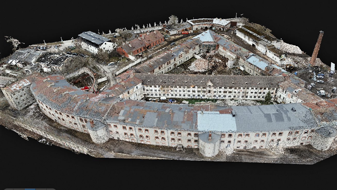
The Patarei Sea Fortress was measured using a laser scanner and a drone, and geodetic surveys of the area were carried out. Patarei Merekindluse punktipilv Patarei Merekindluse punktipilv Patarei Merekindluse punktipilv Patarei Merekindluse punktipilv Patarei Merekindluse punktipilv Patarei Merekindluse punktipilv Patarei Merekindluse punktipilv Patarei Merekindluse punktipilv Patarei Merekindluse punktipilv
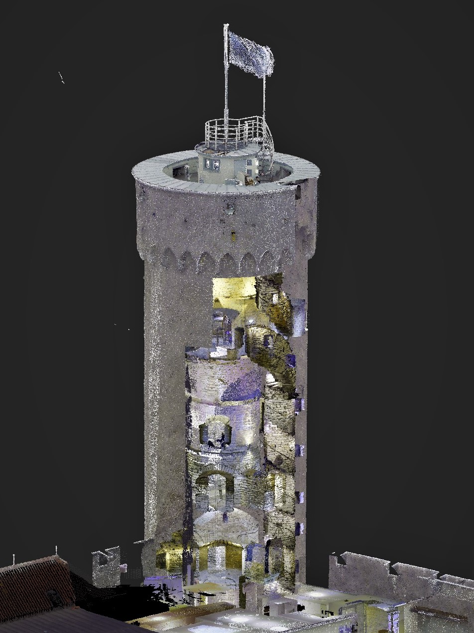
At the request of the Chancellery of the Riigikogu, the Toompea Castle building complex were surveyed using a Leica RTC360 laser scanner and a DJI Phantom 4 Pro drone. Laser scanning and drone surveying as well as point cloud processing resulted in a 3D point cloud model. The point cloud model of the external […]
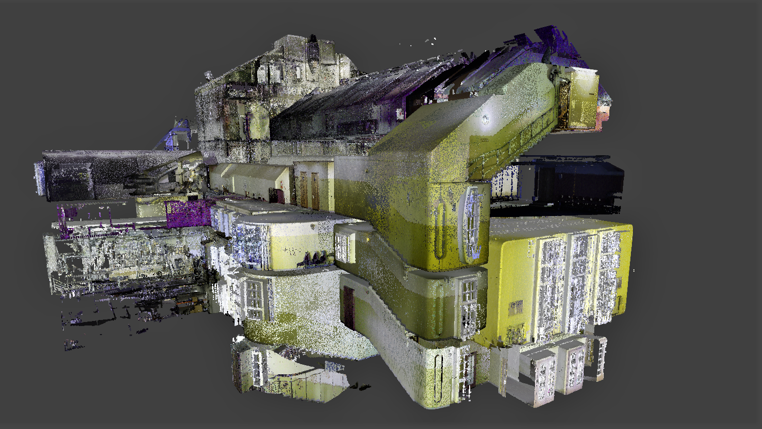
The large, small and painting halls of the Estonian Drama Theater were measured using a Leica RTC laser scanner. Laser scanning was performed with the images, resulting in a colored point cloud. Based on the point cloud, precise stage plans are created, which will be used by stage artists, sound and lighting technicians and others. […]
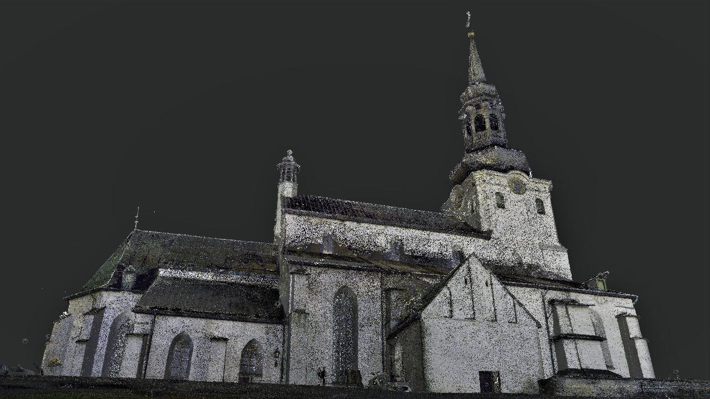
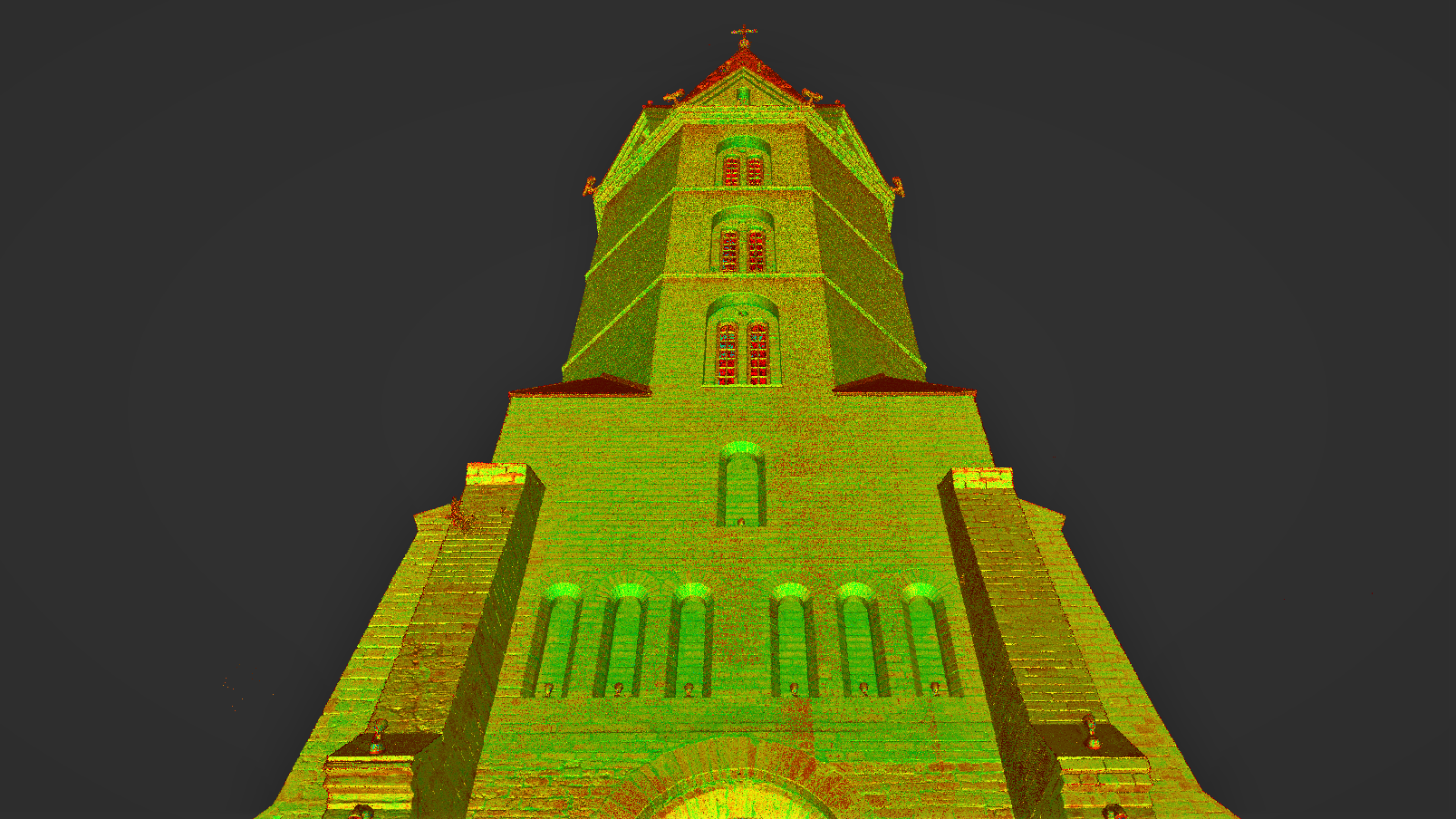
St. Mary’s Cathedral in Tallinn (Dome Church) was measured using the laser scanner Leica RTC360 and drone. The project is carried out in cooperation with Archaeovision OÜ. Tallinna_Toomkirik_Droonifoto Tallinna_Toomkirik_Droonifoto Tallinna_Toomkirik_Droonifoto Tallinna_Toomkirik_Laserskaneerimine Tallinna_Toomkirik_Laserskaneerimine Tallinna_Toomkirik_Laserskaneerimine Tallinna_Toomkirik_Laserskaneerimine Tallinna_Toomkirik_Laserskaneerimine Tallinna_Toomkirik_Punktipiv Tallinna_Toomkirik_Punktipiv Tallinna_Toomkirik_Punktipiv
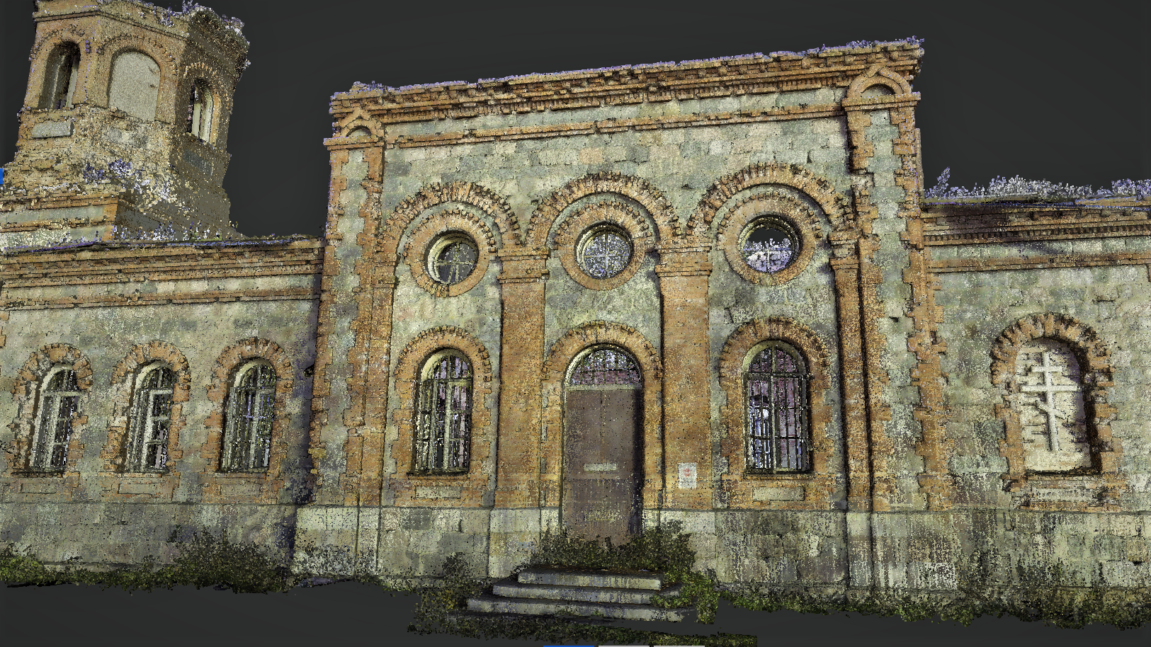
The St. Neva Alexander Church in Lihula was measured using a Leica RTC360 laser scanner. The project was carried out in cooperation with Archaeovision LLC. Lihula Püha Neeva Aleksandri kiriku laserskaneerimine Lihula Püha Neeva Aleksandri kiriku punktipilv Lihula Püha Neeva Aleksandri kiriku punktipilv Lihula Püha Neeva Aleksandri kiriku punktipilv Lihula Püha Neeva Aleksandri kiriku punktipilv […]
For the restoration project of the Narva Alexander’s Cathedral, DataCap carried out a 3D survey of the cathedral using a laser scanner and a drone. Based on the point cloud model obtained from the survey, DataCap will start compiling a detailed 3D model in Archicad. The restoration project is being prepared by Riigi Kinnisvara on […]
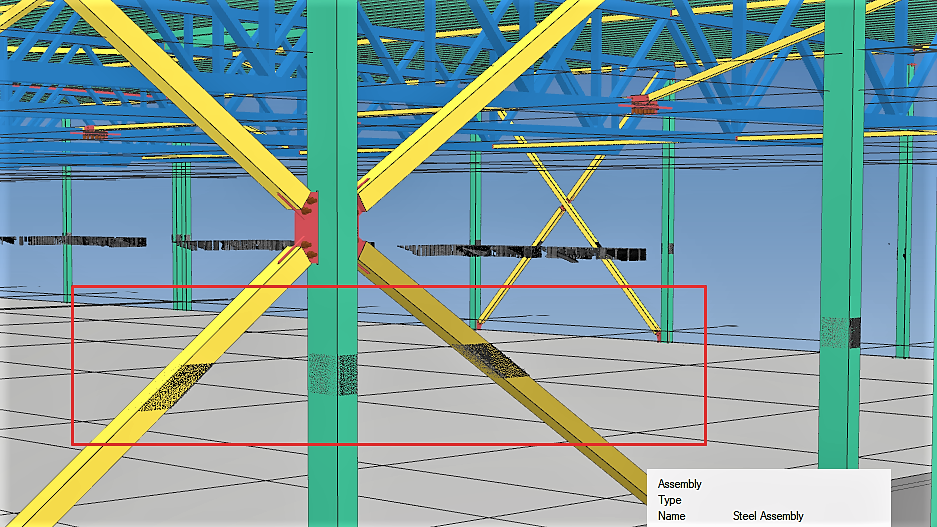
At the request of Tulitec OÜ the control measurement of the construction of AS YIT Eesti construction site was performed using a laser scanner Leica RTC360. The aim of the work was to compare the conformity of the construction to the project. The point cloud analysis of the project model was performed by Tulitec OÜ.
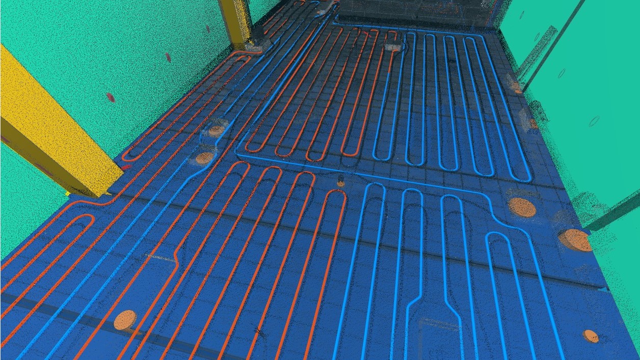
At the construction site of the Port of Tallinn cruise terminal (AS YIT Eesti ), as-built survey of underfloor heating systems is performed using the laser scanner Leica RTC360. The point cloud analysis obtained as a result of laser scanning is performed by Tulitec OÜ.
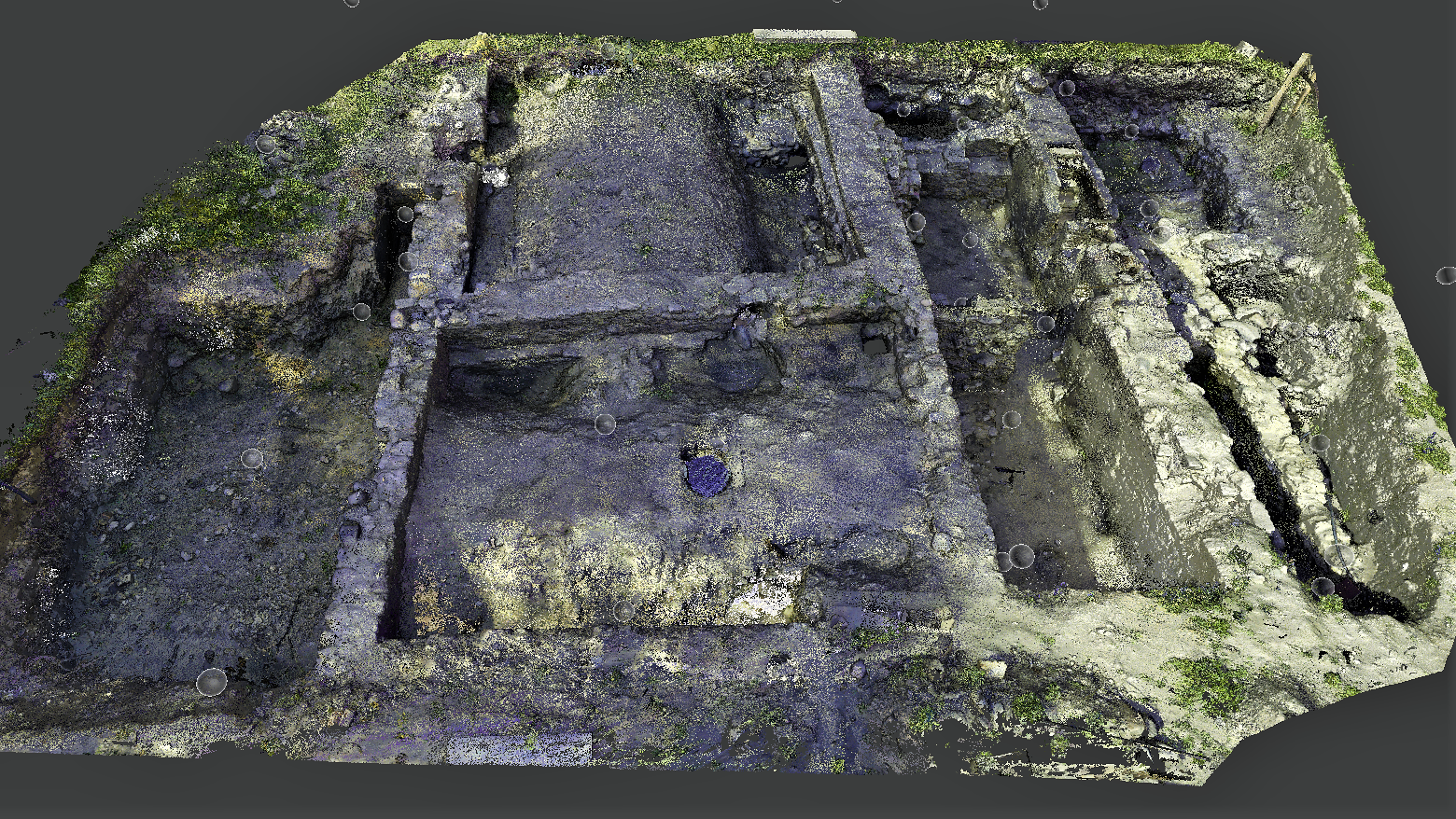
In Haapsalu, at the crossroads of Rüütli and Linda streets, medieval walls and cellars were found during excavations. The Leica RTC360 laser scanner was used for coloured laser scanning for documentation purposes. A colorful point cloud model was handed over to the customer. The project was performed in cooperation with Archaeovision OÜ.
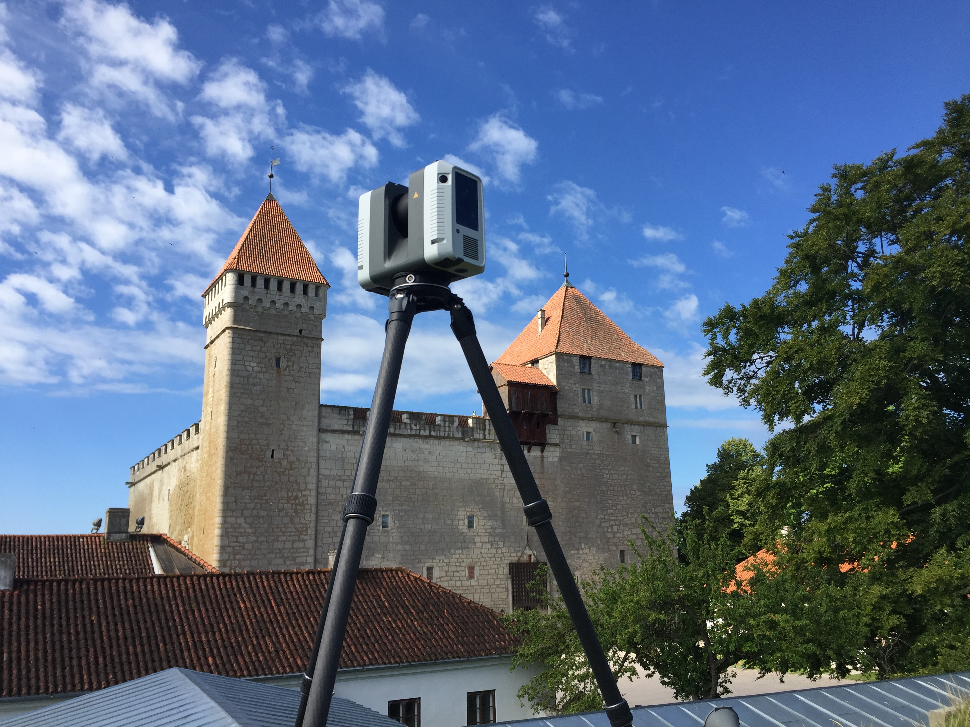
Kuressaare Castle was measured using laser scanner Leica RTC360. Total amount of scanning stations: 600.