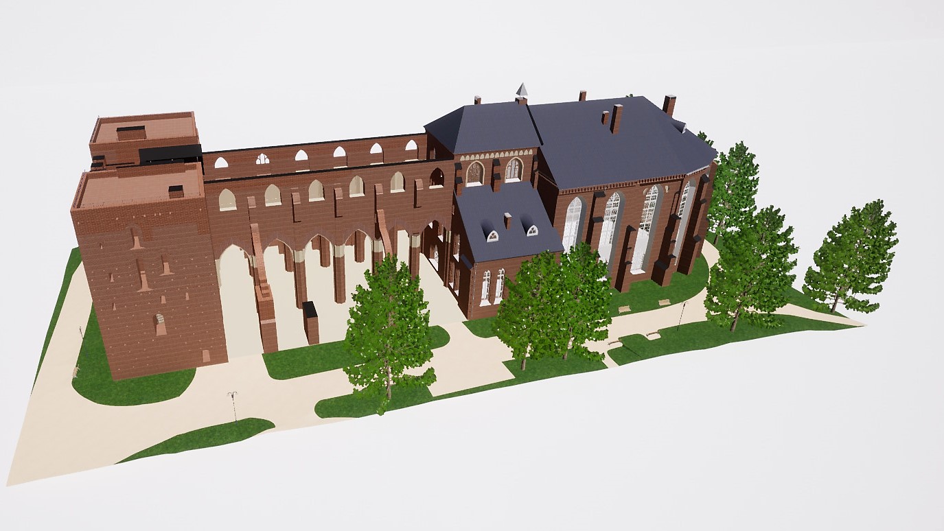
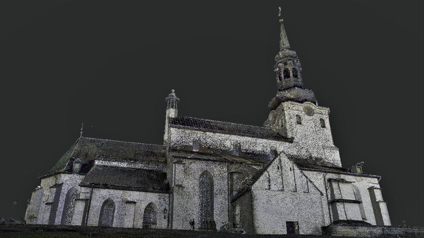
Tartu Toomkirik – punktipilv Tartu Toomkirik – punktipilv Tartu toomkirik – droonifoto Tartu toomkirik – droonifoto Tartu toomkirik – 3D BIM mudel Tartu toomkiriku 3D mudel
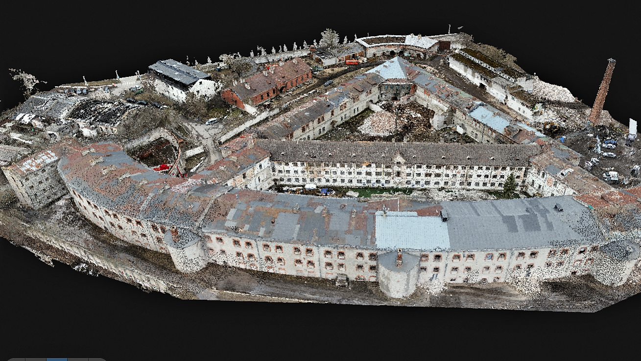
The Patarei Sea Fortress was measured using a laser scanner and a drone, and geodetic surveys of the area were carried out. Patarei Merekindluse punktipilv Patarei Merekindluse punktipilv Patarei Merekindluse punktipilv Patarei Merekindluse punktipilv Patarei Merekindluse punktipilv Patarei Merekindluse punktipilv Patarei Merekindluse punktipilv Patarei Merekindluse punktipilv Patarei Merekindluse punktipilv
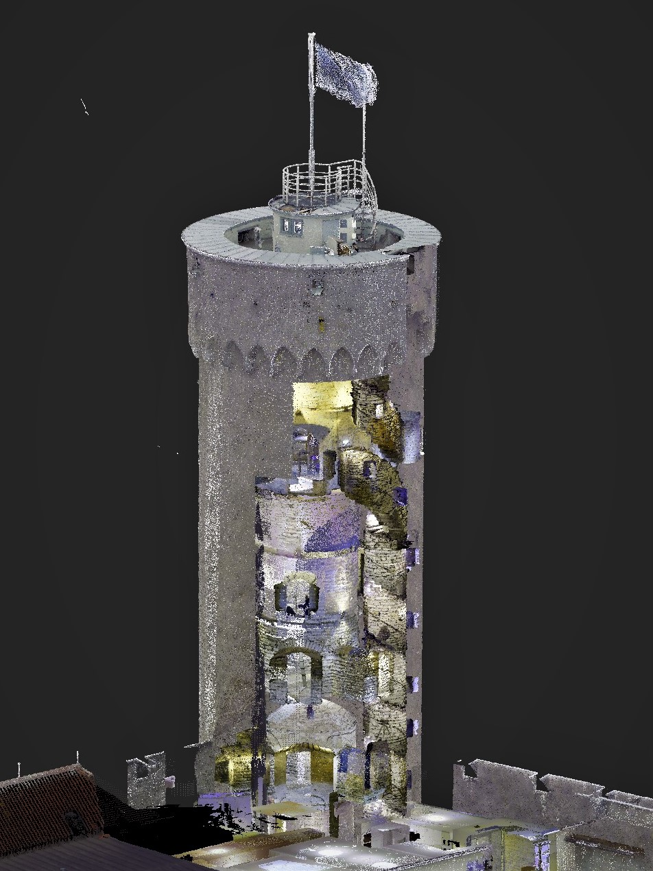
At the request of the Chancellery of the Riigikogu, the Toompea Castle building complex were surveyed using a Leica RTC360 laser scanner and a DJI Phantom 4 Pro drone. Laser scanning and drone surveying as well as point cloud processing resulted in a 3D point cloud model. The point cloud model of the external […]
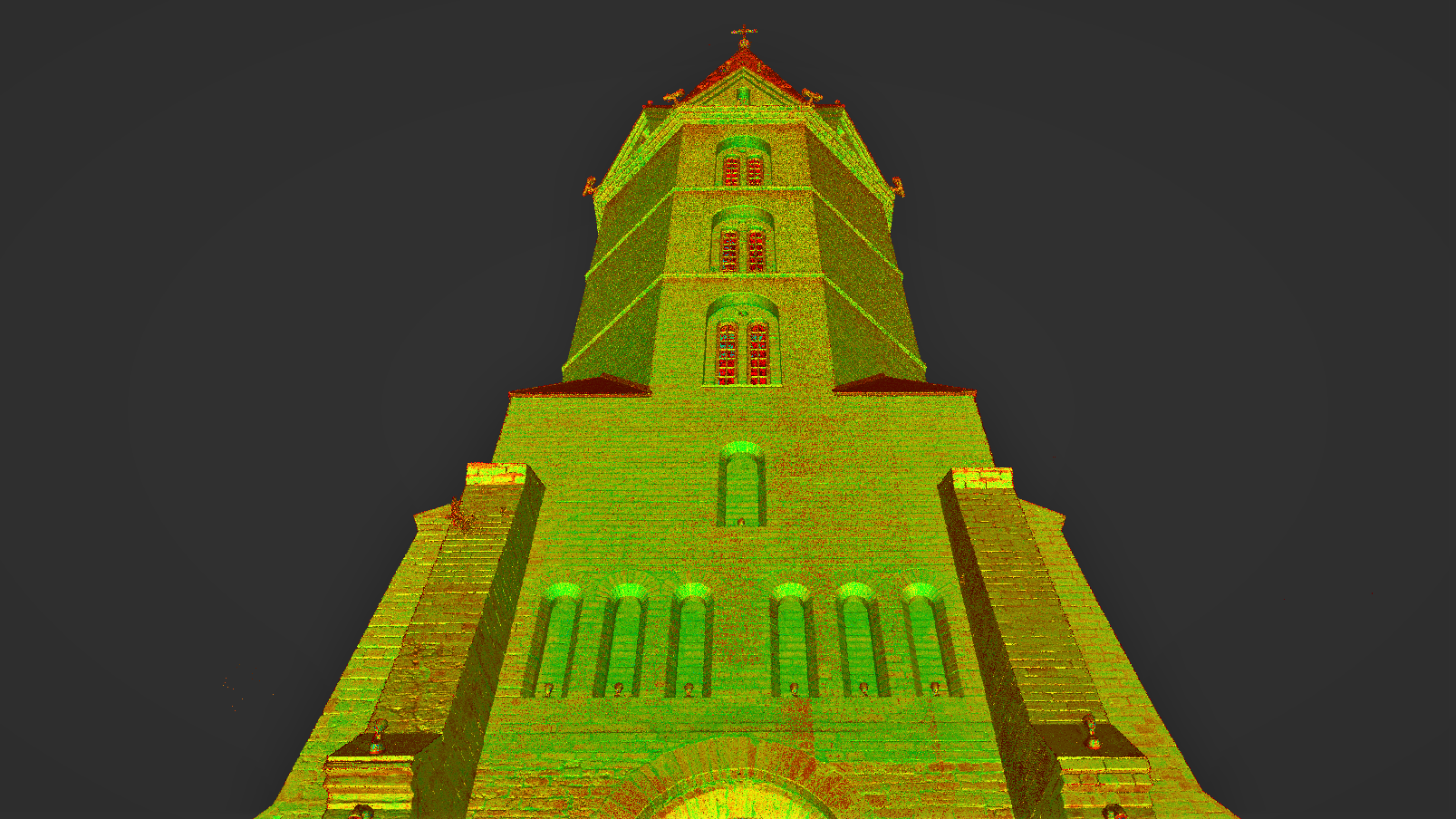
St. Mary’s Cathedral in Tallinn (Dome Church) was measured using the laser scanner Leica RTC360 and drone. The project is carried out in cooperation with Archaeovision OÜ. Tallinna_Toomkirik_Droonifoto Tallinna_Toomkirik_Droonifoto Tallinna_Toomkirik_Droonifoto Tallinna_Toomkirik_Laserskaneerimine Tallinna_Toomkirik_Laserskaneerimine Tallinna_Toomkirik_Laserskaneerimine Tallinna_Toomkirik_Laserskaneerimine Tallinna_Toomkirik_Laserskaneerimine Tallinna_Toomkirik_Punktipiv Tallinna_Toomkirik_Punktipiv Tallinna_Toomkirik_Punktipiv
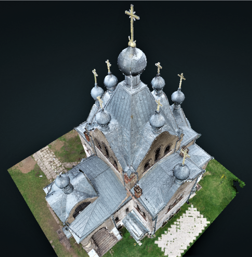
For the restoration project of the Narva Alexander’s Cathedral, DataCap carried out a 3D survey of the cathedral using a laser scanner and a drone. Based on the point cloud model obtained from the survey, DataCap will start compiling a detailed 3D model in Archicad. The restoration project is being prepared by Riigi Kinnisvara on […]
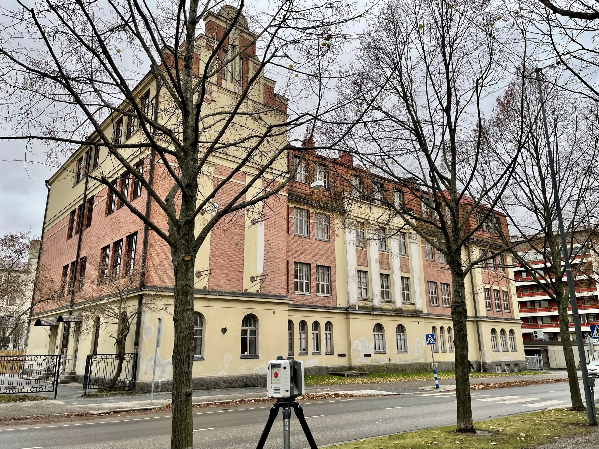
Together with Archaeovision OÜ, we measured the roofs and facades of Tartu Holy Alexander Church. We used a drone and a laser scanner. The survey was necessary for the roof repair project. The point clouds from the laser scan and drone photogrammetry were joined together to cover “holes” that were not visible in either the […]